


James Imray Nautical Chart Vintage Map 1851
$423 $5,000
Pay in 4 interest-free payments of $105.75
with ![]() .
Learn More
.
.
Learn More
.
Size
Like and save for later
Add To Bundle
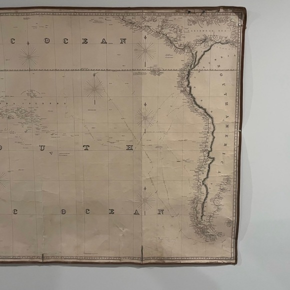
A 1851 New Chart of the South Pacific Ocean Including Australia, the East India Islands. This exotic map nas obviously been at sea, and the condition issues enumerated below provide a genuine appeal to the map, making it suggestive of the day when clippers sailed the high seas and navigators navigated courses with compasses, sextants and sea charts.
Shipping/Discount
Posh Protect: Buyer Protection Policy
Get your order as described or receive your money back. Learn More.


cats2332351
and
2 others
like this
4 Comments

mark__cvb78
Do you still have it available for sell? if yes, kindly send the pictures to me 408//640//8311 so i can purchase it. Thanks as i look forward to having this lovely piece.
Sep 18Reply
cats2332351
@mark__cvb78 yes it’s still available. Let me know what kind of pictures you want to see and I’ll post them
Sep 18Reply

kathyfree
@cats2332351 what are the measurements? I’m very interested.
Jan 15Reply
cats2332351
@kathyfree hi they at 38 3/4”H x 73” L
Jan 15Reply


Find Similar Listings
About the seller
@cats2332351
Last Active: Feb 16
30
Listings10+
Sold Listings2 days
Avg. Ship time2
Love NotesAbout the seller
@cats2332351
Last Active: Feb 16
