


Vintage 1980 Chesapeake Bay Approaches To Baltimore Harbor Map 48" X 36" NOAA
$40 $95
Pay in 4 interest-free payments of $10
with ![]() .
Learn More
.
.
Learn More
.
Size
Like and save for later
Add To Bundle
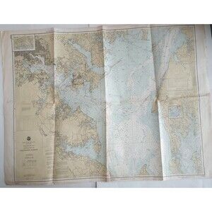
This is a vintage map from 1980 that shows the Chesapeake Bay approaches to Baltimore Harbor. It is a large, high-quality map that measures 48 by 36 inches and is ideal for collectors and map enthusiasts. The map was produced by the National Oceanic and Atmospheric Administration (NOAA) and is a great addition to any collection of maps or nautical memorabilia.
It is in good, vintage pre-owned condition with some soiling, folds, tears and writing in pen.
Shipping/Discount
Posh Protect: Buyer Protection Policy
Get your order as described or receive your money back. Learn More.


Find Similar Listings
About the seller

@janetmolashryen
Last Active: hours ago
Marion Center, PA
1215
Listings400+
Sold Listings1 day
Avg. Ship time49
Love NotesAbout the seller
@janetmolashryen
Last Active: hours ago
Marion Center, PA
